

Long Island, New York, Outdoors, United States
34 Beautiful Long Island Hiking Trails to Explore From East to West
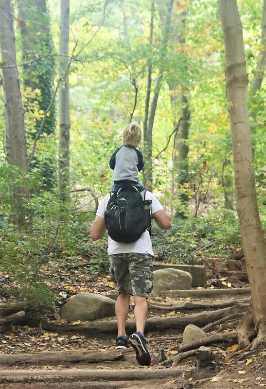
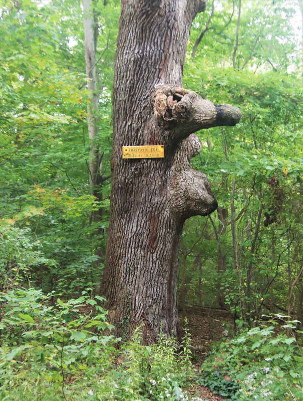
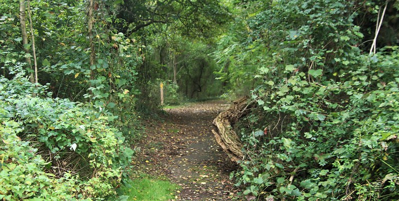
Long Island is a land of opposites. For every acre of verdant, open land, there’s another pocket that’s been developed into a strip mall or residential housing complex. So most people coming for Long Island hiking only think to visit the most popular, open parks. These are indeed excellent locations to hike, but there are also so many Long Island hidden gems and natural wonders tucked between the development. They just take a local’s insight to find. And that’s what we’re here for! So get your GPS ready, and let’s take you on some pretty epic Long Island hiking trails.
Table of Contents
Getting to These Hiking Trails on Long Island

Trains to Long Island
Here are the main train lines to consider when coming out for Long Island hiking.
- Ronkonkoma Line – running through the middle of the island.
- Port Jefferson Line – goes through the northern end.
- Southern Line – runs mostly through the denser parts of Long Island
- Northern Line – takes travelers relatively close to some of the North Shore’s nicest and most manicured hiking spots, especially toward the end of the track.
If you’re coming from New York City, a smart plan would be to either grab an Uber or take a bike with you and get off at one of the major towns like Huntington, Smithtown, St. James, Stony Brook, or Port Jefferson train stations, then ride out to the spot you’re looking to hike. If you’re biking, remember to stick to the sidewalks. Long Island drivers like to go fast, even on tight, shoulderless roads.
There are also train lines that run out to Montauk and Greenport — some of our favorite towns on Long Island, so be certain to look into those.
Bus Transport Options
- Public Bus: I would avoid the rather inefficient public bus lines if possible, though a few do come close to some Long Island trails.
- Private bus companies: Hampton Jitney can go directly from the city to cute towns in the north or south forks at a higher price than an LIRR train ticket.
Driving to Long Island
In reality, just like in hiking Upstate New York, the best option to get to these Long Island hiking spots is by car. If you don’t have one, consider a car rental or combining the train ride with a Lyft or Uber.
Long Island Traffic: Long Island, despite its suburban legacy, is an incredibly dense place. Nassau is more congested than Suffolk, especially on the parkways during the summer when so many people are looking to get to New York’s best beaches (especially near Jones Beach). However, some of the best hiking spots are toward the eastern end of Long Island. To get there, consider taking the Long Island Expressway around midday on weekdays and on weekends when it is relatively clear.
Local tip: Avoid driving from Long Island during the late Sunday rush by all the Hamptonites who go back to the city for their regular workweek! If you must drive back on a Sunday, make sure it’s after 9 PM or you’ll likely be sitting in traffic.
TOP Tips for Hiking on Long Island

Don’t Be That Hiker
A lot of these places have actually increased in popularity due to the pandemic which inspired more people to reconnect with nature. The downside is that there will be more people on trails who may be new at caring for nature. If that’s you here are some quick pointers:
- Leave room for people who may be running or walking at a speed faster than you.
- Mind your noise. Many people come to enjoy nature’s sounds, not yours.
- Always pick up after yourself.
- Take all your garbage back home with you, especially if the garbage bins are overflowing.
Rabbit Season, Duck Season
Hunters are allowed access to many parks during the winter months. If traveling out to hike from October to February, it’s best to check the individual parks and consult the New York DEC timeline for hunting.
Seriously Beware of Ticks
More importantly, however, Long Island is a hotspot for tick populations. There are plenty of both Deer Ticks and Lone Star Ticks lurking in the woods and tall grass which carry several pathogens and diseases including Lyme Disease.
The tick problem has gotten worse over the years alongside rising temperatures and a boom in the numbers of deer. Best practices include:
- Wear long socks and pants tucked into the shoes.
- Use eco-friendly insect and tick repellent. I would advise avoiding DEET products due to a number of well-known drawbacks and health issues. Picaridin may be a better alternative.
- Check your legs, arms, head, and any crevices for ticks.
- When back home, isolate your clothes to the side and hop in the shower to do a thorough search.
If you do find a tick on you, follow CDC guidelines to remove it, then stick that bugger in some alcohol and into a sealed container. Check to see if there are any places nearby that can verify if it was carrying any disease. The local Stony Brook University Hospital has a tick testing center. If you develop a rash on the affected area, do not hesitate to see a doctor or other medical professional.
THE 34 BEST WALKING & HIKING TRAILS LONG ISLAND
This article is divided into two sections: Nassau County hiking trails (west) + hikes in Suffolk County (east). These are the two counties that geographically divide Long Island. So if you’re only looking for Suffolk County hikes, scroll down to that section.
The Nassau County Hiking Trails
1. Massapequa Preserve


The Massapequa Preserve is a sweet haven of green space. One minute you’re surrounded by suburbs and traffic, and the next you’re amongst the trees where only the far distant sounds of cars can be heard. This park runs along Massapequa creek, and the trails are full of wonderful sights of ponds and reservoirs. The entire path is paved, which may be more to your liking if you’re trying to go easy or avoid ticks.
Available along some of these same paths is a 15-mile bike trail that runs further north into Bethpage. You can also use this part to do the entire Nassau Suffolk Greenbelt Trail by bike, a 20-mile jaunt from the South Shore to the North Shore, or vice versa.
- Location: Massapequa, Long Island, NY
- Difficulty: Easy
- Length: 6.3 miles
- Route: Out and back
2. Sands Point Preserve
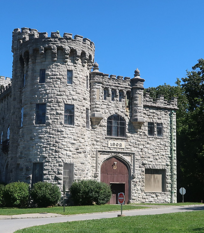

Sands Point Preserve is one of the best hikes on Long Island. It is one of the best examples of Gold Coast, Gatsby-era Long Island. The paths are wide and meant for pleasure strolling more than an intense hike, but this is a great spot for anybody who loves history or wants to learn more about the Guggenheim Estate. Here, you can witness some Americanized castle-esque architecture.
- Location: Sands Point, Long Island, NY
- Difficulty: Easy
- Length: 1.9 miles
- Route: Loop
- Entrance Fee: $15 USD
3. Sunken Forest Nature Trail + Sailors Haven
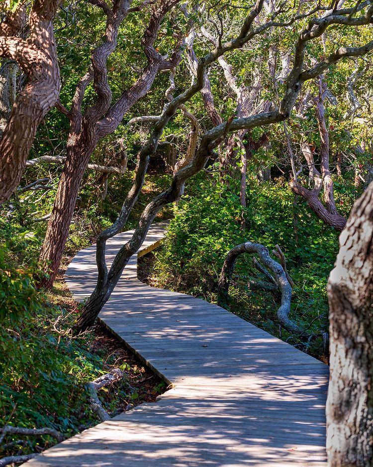
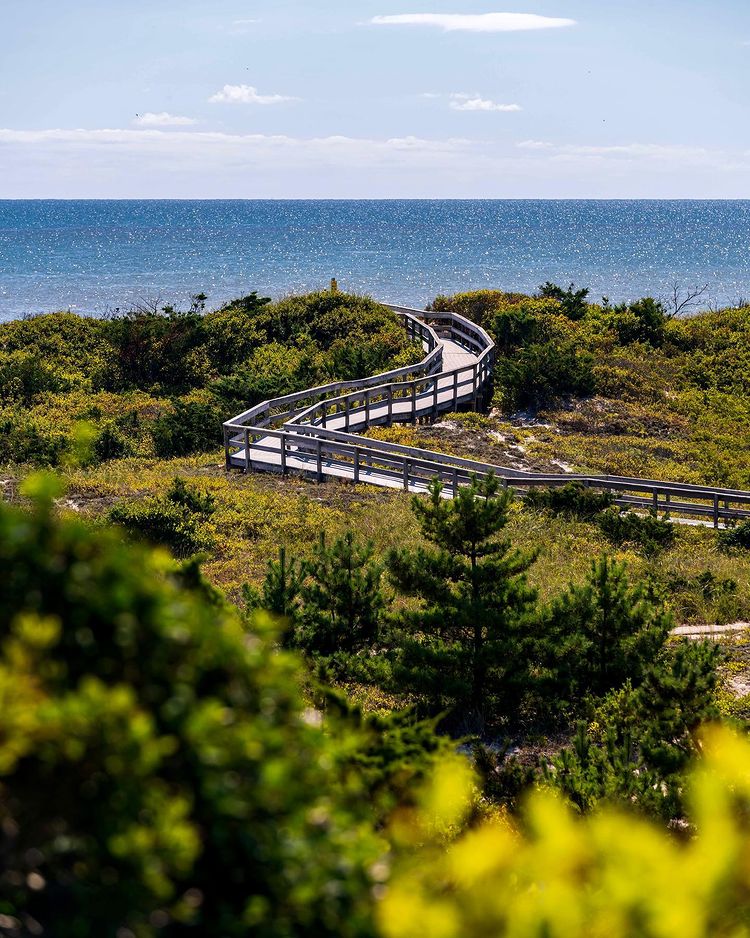
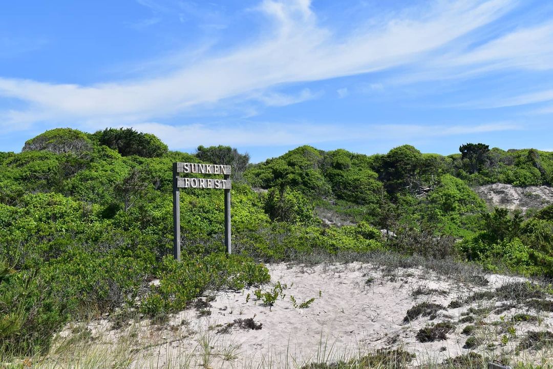
Yes, there is more to Fire Island than partying! The Sunken Forest is one of the most unique places to hike in all of New York. Amid the dunes and sand lies an extremely rare maritime holly forest with long, thin trunks rising up and spreading overhead like an umbrella. And of course, the dunes and beach are not something to be missed, especially with its might views of the Atlantic Ocean and miles of isolated beach.
The Sunken Forest Nature Trail hike itself is only 2 miles point to point but 4 miles round trip. But consider allocating extra time to enjoy Sailors Haven, a beach area with a cute boardwalk.
Access to the trail is either by taking the Sayville Ferry to Fire Island or by crossing the bridge to Robert Moses State Park.
- Location: Fire Island, Long Island, N.Y.
- Difficulty: Easy
- Length: 4 miles
4. Stillwell Woods Park + Trail View State Park


This is one of the more trotted trails on this list. Trail View State Park is directly connected with Stillwell Woods and thus often frequented by mountain bikers. Some hikers may get lost by accidentally going onto the mountain bike trails, so remember to stick to the wider paths. The route from Stillwell to Trail View offers loads more sights, which is why I combined both as one hike here.
The path from one park to the other goes through an underpass underneath the train tracks, which is pretty unique on Long Island. Stillwell also features a wide, grassy field that’s full of wildflowers and offers a nice strong breeze to cool you down on a hot day.
- Location: Woodbury, Long Island, N.Y.
- Difficulty: Easy to moderate
- Length: 7 miles
5. Muttontown Preserve
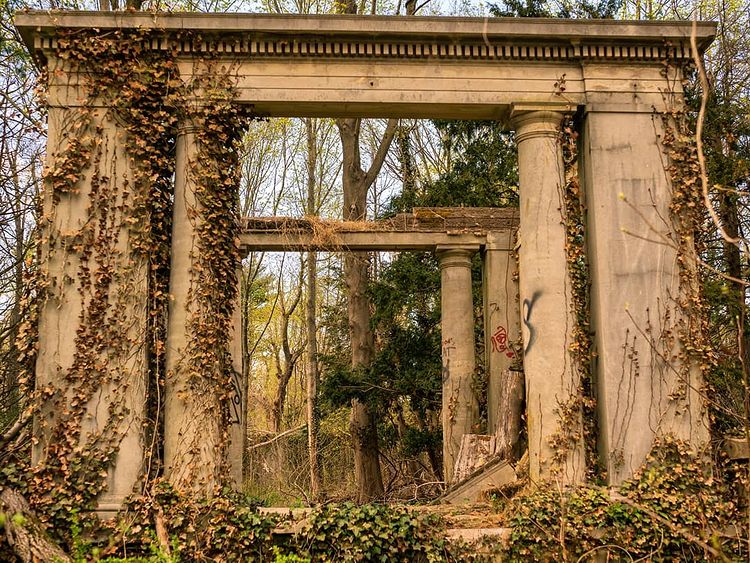

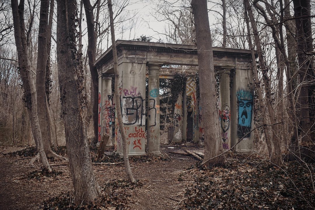
How often can you say you visited the New York estate of an exiled Albanian king? You can at the Muttontown Preserve! Spanning 550 acres, this is Nassau County’s largest preserve. This unique natural space offers both nature and a fair bit of local history.
That bit about the exiled king of Albania is true. King Zog bought the 150-acre estate in 1951, though he never lived there and sold it off a few years later. There are paved and dirt paths through mostly wooded areas, but along the way, you’ll find small bogs, old pagodas, and other examples of decrepit architecture that has since seen a fair bit of graffiti. Personally, I appreciate street art, as it adds to the feeling of use throughout the ages. It just adds to the mystery of the place and offers even more reason to stop and inspect the sights along the trail.
- Location: Muttontown, Long Island, N.Y,
- Difficulty: Easy
- Length: 3 miles
Suffolk County, Long Island Hiking Trails
6. Cold Spring Harbor State Park ★
This hike has some hilly terrain, but nothing that most experienced hikers can’t handle. Cold Spring Harbor State Park offers some birdwatching and views of the harbor through the tree line. The area is especially nice during the fall foliage season, marked by the gentle curving slopes. The park is notable for many of its large, preserved trees.
It offers at least two different woodland trails: (1) Nassau-Suffolk Trail: Cold Spring Harbor to Uplands Farm Sanctuary (5.4 miles) and (2) Cold Spring Harbor Trail (1.8 miles). The first trail also connects to the Uplands Farm Sanctuary, making it a nice, two-pronged hike through a long-preserved area.
About Uplands Farm Sanctuary in Cold Spring Harbor State Park

The Farm Sanctuary is a little slice of pastoral bliss. The site was once a dairy farm but was later preserved by the Nature Conservancy. You can visit the Nature Conservancy’s site to get a few more details about the site’s history. Very few people know about the site so there is rarely much foot traffic on the trails.
- Location: Cold Spring Harbor State Park
- Length: 1.8 to 5.4 miles
- Route: Out and back
- Difficulty: Moderate
7. Caumsett State Historic Park Preserve ★

Located on a peninsula, Caumsett State Historic Park Preserve is really one-of-a-kind. It used to be a large estate, but the property has since been turned into a nature preserve that offers over 5 miles of hiking if you do the Caumsett State Historic Park Preserve Perimeter Loop. This trail goes through forested paths, dunes, meadows, and a shoreline. You’ll also see an English-style manor that was owned by the Field Family until it was bought by the state in 1961.
With its variety of sights and attractions, from the house to the beach to the marshes, it’s really a hike for any skill level. There’s also a mix of dirt and paved paths, with lanes wide enough for less tick risk as well.
- Location: Lloyd Harbor, Long Island, N.Y.
- Difficulty: Easy
- Length: 5 miles
- Entrance: $8 USD vehicle fee
- Route: Loop
8. West Hills County Park

West Hills County Park offers plenty of interesting flora and fauna to admire as well as some historical Walt Whitman attractions. The Walt Whitman Trail goes up to Jayne Hill, which is also at Long Island’s highest elevation. The path up there is relatively steep and is what makes this trail a bit harder than others, but it’s still optional.
It’s a good idea to bring a map or a navigation app with you, as some trails are pretty poorly marked. Still, what makes this hike great is not only the pleasant forest scenery but the fact it’s not crowded.
- Location: Melville, Long Island, N.Y.
- Difficulty: Easy to moderate
- Length: 7 miles
- Entrance: $13 parking fee for people going to the main parking lot on Sweet Hollow Road between Memorial Day and Labor Day.
9. Edgewood Oak Brush Plains Preserve


This is a great trail if you’re a fan of oak and pine, and you’ll see both aplenty in Edgewood alongside both paved and dirt trails. There are never too many people here, though there are some mountain bike trails to be aware of so you don’t get hit by a wayward bicyclist. There are a few sites where the scenery opens up into wide grassland where you might spot a family of deer or mice scuttling across the path. Access to the trail is off Commack Road and is pretty easy to find.
Edgewood is an all-around good hike, especially for beginners or when bringing the family. Some trails are not as clearly marked as they should be, but just keep a phone on you and you should be fine.
- Location: Deer Park, Long Island, N.Y.
- Difficulty: Easy
- Length: 3 miles
10. Sunken Meadow State Park


With paths along bluffs, hardwood forests, and trails running through Sunken Meadow Creek, the trails around Sunken Meadow State Park are really quite unique for Long Island. Three bridges allow hikers access to the trails from the beach and parking lot areas. My favorite sights are the tidal flats toward the entrance to the creek from the Long Island Sound. Others have said this trail is rather hilly, making it a bit harder on the legs, but I find it’s quite a nice jaunt, and having the differing topography adds a bit of spice to an area that’s usually pretty flat to walk around. Access to the park is southeast from either of the parking lots coming off Sunken Meadow Parkway, or from Old Dock Road running east from Sunken Meadow Road.
Of course, this is a heavily trafficked trail for how popular the beach and park is. The benefit is the loop is pretty clearly marked, and you can stop pretty much anywhere along the trail to get an interesting view.
- Location: Kings Park, Long Island, N.Y.
- Difficulty: Moderate
- Length: 4 miles
- Route: Loop
- Entrance Fee: $8-10 parking fee during peak months from April through September
11. Nissequogue River State Park

While the Nissequogue River State Park is mostly known for its boating, canoeing, and kayaking activities (which shouldn’t be understated), there is also the Nissequogue River Paddle Route. This trail goes alongside the river, roving off and on trails and old roads.
The most interesting bit of scenery, other than the river itself, is the old Kings Park Asylum that has long sat abandoned in the center of the park. State and county lawmakers have long been trying to turn that property into something, but for the time being it’s well worth taking a look.
Of course, if you’re here, you should really look into options for rowing downriver. It’s a perfect date activity, with very easy currents and some nice scenery on both sides of the river.
- Location: Kings Park, New York
- Length: 4.9 miles
- Difficulty: Easy
- Route Type: Point to point
12. Blydenburgh County Park


The Blydenburgh County Park Stump Pong Loop runs along the Nissequogue River and around the entire Stump Pond (aka Blydenburgh Lake). This is the perfect trail for hikers of all levels. This is easily one of my favorite sites on Long Island. Since it is a pretty well-trafficked park, you will likely see quite a few people out on the trails, especially on weekends or holidays. Consider a weekday visit to be able to experience the beauty of this man-made lake and surrounding forest.
Stump Pond was created in the late 18th century by the titular Smith Family who dammed the waters off Nissequogue River, trying to create a grist mill. There is a route around the entire circumference of the pond, making it a very quaint and relaxing hike over forest trails and boardwalks. You may also see some horseback riding and bikers along the trail.
Lastly, for those interested in history, look out for the beautiful historic homes dating back to the post-Revolutionary times.
- Location: Smithtown, Long Island, N.Y.
- Difficulty: Easy
- Length: 6 miles
- Route: Loop
13. David Weld Sanctuary


For a short, nature-focused hiking trail, head to the David Weld Sanctuary for some nature watching. This trail rolls down from a cedar-lined forest to an isolated, stony beach. It’s rare to have a public and quiet stretch of North Shore Beach, so it really is something special.
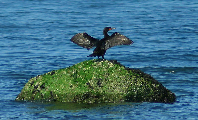
The trail also offers the sights and sounds of several small freshwater pools where you’ll likely see a few frogs hopping along. On the shore, you’ll be able to look out at the large, algae-covered rocks where you might find any number of birds as they make pit stops during their migrations.
- Location: St. James, Long Island, N.Y.
- Difficulty: Easy
- Length: 2 to 3 miles
- Route: Loop
14. Avalon Nature Preserve

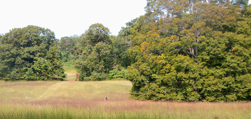
The Avalon Nature Preserve has over 5 miles of trails with a variety of beautiful scenery including meadows, forest, sassafras groves, and even a few historic buildings and art sculptures. The trails are relatively quick and they all connect in some way, so I suggest trying a few. You can start your hike at the beautiful Mill Pond (pictured above), an excellent place to stop and watch the geese and ducks.
The Paul Simons Foundation and an attentive team of volunteers maintain the park year-round, so be sure to help them out by leaving no trace. Visit during any season and you will find something new to see. Avalon is one of my personal favorite places to hike on Long Island!
- Length: 3.6 miles
- Difficulty: Easy
- Route: Loop
- Location: Stony Brook, Long Island, N.Y.
15. Pirate’s Cove (McAllister County Park) ★

McAllister County Park is located on a peninsula sprouting from Port Jefferson Harbor. It’s a truly wonderful spot where you can hike along the 113 acres of beach next to the rolling dunes and beachgrass. In one direction, you’ll be able to look out at the dark waters of the Long Island Sound. On the other side, you’re given the vista of Port Jefferson Harbor.
Parking is a little tricky and there is a cop that patrols the lot every minute. So (if you’re lucky) you can either hike from the parking lot (if you get a spot) or hike from the beach area in town for about 3+ miles in a loop. The roads leading up to Pirate’s Cove are through the affluent village of Belle Terre.
- Location: Port Jefferson, Long Island, N.Y.
- Difficulty: Easy
- Length: 0.5 to 3.2 miles
- Route: In and out (or loop)
16. Setauket-Port Jefferson Station Greenway Trail

The Setauket-Port Jefferson Greenway Trail was laid down from 2009 to 2014 as a rails-to-trails project after New York State proposed creating a bypass for Route 25A. It’s served as an example for several trails built on Long Island thanks to community involvement.
The entire trail is paved, and though it’s hilly it’s not especially hard for walking/hiking. Biking, however, can be a little more difficult, and it’s good to be cautious if you’re cycling downhill so you can avoid any nasty collisions.
The trail runs through the woods and past several neighboring streets. It probably isn’t the prettiest trail on Long Island (although it’s certainly pleasant) but the reason it makes it onto this list is that if you combine this hike with the next one on this list, you could potentially hike or bike over 13 miles from Setauket all the way to Wading River.
- Location: East Setauke/Port Jefferson, Long Island, N.Y.
- Difficulty: Easy to moderate
- Length: 5.1 miles
17. North Shore Rail Trail (fka Rails to Trails Recreational Path)
The North Shore Trail is probably the newest item on this list of Long Island Hiking trails. This trail runs all the way from the edge of the Mount Sinai hamlet to the far edge of Wading River. It’s located underneath the power lines and runs through land that used to be train tracks.
No, this isn’t the prettiest hike on this list. The trail runs behind a few strip malls and on the other side of people’s property. There are nice, long stretches of trees and tall grass that do make it a pleasant trip especially for bikers. You also pass by the Tesla Science Center, which is the site of famed scientist Nikola Tesla’s last laboratory.
The big reason this trail is on this list is that there’s an amazing opportunity to connect this with Stony Brook’s Avalon Preserve (mentioned above) and then Setauket’s Greenway Trail (also mentioned above). Taking this all the way down also gives you access to the North Fork’s wine country!
- Location: Mount Sinai, Long Island, N.Y.
- Length: 10 miles
- Difficulty: Easy to moderate
18. Brookhaven State Park
The Brookhaven State Park offers about 5 different hiking trails of varying lengths. The most popular one is the Long Pong and Green Trail Loop which we’ll cover here. While it’s the most popular, the good news is that it’s not crowded here. This quiet hike offers mostly flat and sandy ground enveloped by verdant pine trees. Not a whole lot to see beyond the pond, but it’s a nice walk in the woods if you’re nearby.
Another popular trail here is the Wading River Road Loop, which is slightly shorter and doesn’t go near the pond. In the winter, you can enjoy snowshoeing here. Be careful with chiggers here.
Location: Wading River, New York
Length: 1.7 miles to 5.1 miles.
Difficulty: Easy to moderate
19. Wading River Marsh Preserve (East & West Loop)
This trail winds over a bridge across marshland, through the shrubbery, and into the Wading River wetlands. This hike is a really short jaunt, but well worth it if you’re already in this neck of the woods. Here, you can also see the remains of the old Shoreham nuclear power plant. This powerplant was actually never used due to a complex history but it ended up influencing Long Island’s electrical infrastructure.
Location: Wading River, New York
Length: 1.6 miles
Difficulty: Easy
Route type: Loop
20. Wildwood State Park ★

Wildwood State Park is a sprawling, 600-acre park with a campground and other amenities. A lot of families come here for weekend getaways, so you’ll likely see some campers parked here on the weekdays.
Wildwood State Park Loop Trail is also a great way to get into hiking. It’s easy with no real steep gradients and offers a nice variety of scenery. Unfortunately, a large part of the trail following near the dunes has eroded and been blocked off. But this trail still makes the list of best hikes on Long Island. Don’t miss the spread of wildflowers
- Location: Wading River, New York
- Length: 3.2 miles
- Difficulty: Easy
- Route type: Loop
- Entrance Fee: $8-10 for vehicles
21. Long Island State Pine Barrens Preserve


The Long Island Pine Barrens is the largest protected green space on Long Island, and for good reason. This spot of green is Long Island’s soul-source aquifer for drinkable water. There have been decades of work to protect this green space on behalf of both volunteers and elected officials. This large area encompasses several state parks and trails that have already been mentioned on here. Such as:
- Brookhaven State Park
- Prosser Pines Nature Preserve
- Wertheim National Wildlife Refuge
- El’s Wampmissick Trail
- Cranberry Bog Nature Preserve
- Indian Island Country Park
- Dward Pine Plains
- Quogue Wildlife Refuge
- Sears-Bellows County Park
There are different hikes in the region. You could easily make a full-day trip in this region, hitting different parks/hiking spots. Come to the pine barrens to get lost among nature. Just remember to bring water and some kind of GPS device to navigate by.
22. Manorville Hikkes County Park Walking Trail
The Pine Barrens live up to their name, with two sprawling trails that loop together at the two ends of the pine barrens full of beautiful, low-growing pitch pines and scrub oak. There is also an opportunity to take these trails all the way southeast toward Manorville, so if you want to turn a 12-mile hike into a 17-mile hike, be on the lookout for that. Access is available both along Route 25 in Ridge and at several points along Route 25A in Rocky Point.
- Location: Manorville and Rocky Point, New York
- Difficulty: Easy to moderate
- Length: 6.1 to 20+ miles
Quogue Wildlife Refuge


The nonprofit that protects the Quogue Wildlife Refuge has maintained the land for nearly a hundred years, and for good reason. It is an absolutely beautiful area overlooking Old Ice Pond and Quantuck Creek. There is a good variety for a few-hour hike called the Red, Yellow, and Green Loop. Here you can hike through wetlands, estuaries, forest areas, the pond, and the Refuge’s Nature Center. Allocate some time to see the exhibits here.
Quogue Wildlife Refuge is also a great place to visit in winter, as the nonprofit hosts a Light the Night Trail Walk. The refuge places little lights all along the paths, making it a great, romantic night out.
- Location: Quogue, New York
- Length: 3.1 to 7 miles
- Route Type: Loop
- Difficulty: Easy
23. Hubbard County Park


There are a number of small parks in the Hampton Bays area, but if I had to choose one, it would be Hubbard County Park for the biodiversity. This hike is mostly pine trees abutting a salt marsh where you’ll likely be able to spot clam and scallop beds as well as the occasional heron bird.
Just be aware that this trail at one point appears to cuts through a person’s yard. But beyond that, it’s a nice, peaceful, and unique hike.
Bonus” Other nearby parks include the Westhampton Dwarf Pine Planes Preserve and the David A. Sarnoff Preserve. Also around here, you can also hike the Paumanok Path Trail which takes hikers along a 20-mile trail west to east of Long Island.
- Location: Sears Bellows Park, Hampton Bays, New York
- Difficulty: Easy to Moderate
- Length: 2.6
- Route Type: Out & back
24. Sound View Dunes Park Forest

The Sound View Dunes Trail is known for its variety of terrain, including both dirt and sand. And because it’s out of the way, it’s likely to be mostly empty so you might have it all to yourself.
The hike is also biodiverse, as you’ll be going through wetlands, marsh, forest, and dunes. There are also a number of swale landforms, which are naturally occurring depressions between the dunes. Lastly, there is a public beachfront without the crowds! These kinds of short hikes are opportunities to slow down and admire the bounty of nature around you.
- Location: Southold, New York
- Difficulty: Moderate
- Length: 1.6 miles
- Route type: Loop
25. Big Woods and Wolf Swamp Preserve
As a lover of biodiverse hikes, this is another Long Island hiking trail that I love. There are groves of white pine and red maple as well as wetlands and the Big Fresh Pond. And if you’re into waterfowl birds, you’re likely to see plenty between the wetlands and the lake. It’s not an extensively hiked preserve, so you’re more likely to be alone with the animals. If you’re into nature photography or birdwatching, it’s an excellent place to visit.
- Location: Southhampton, New York
- Length: 2.3 miles
- Difficulty: Easy
- Route Type: Loop
26. Cedar Point County Park


One of the best hikes on Long Island’s South Fork is the Cedar Point Lighthouse Loop Trail. The trail goes out onto the Cedar Point peninsula where you can find the striking Cedar Point Lighthouse overlooking Gardiner’s Bay on one side and Sag Harbor Bay on the other. You’ll also likely see some fishing boats or schooners. There’s really nothing more pleasant than that feeling of maritime bliss from being so close to all the classic icons of seafaring.
- Location: East Hampton, Long Island, New York
- Difficulty: Easy
- Length: 3-5 miles long
- Type: Loop
Bonus: Just 15 minutes driving is the cute town of Sag Harbor, another one of the best places to visit along the South Fork of Long Island. It’s a beautiful place with a vibrant little downtown and a whole lot of history. I recommend visiting some of the bookstores in the area, especially Canio’s Books, which has been around since 1980.
27. Mashomack Preserve


The Mashomack Preserve is a hidden “jewel”, as the Nature Conservancy puts it. Both the conservancy and local advocates of Shelter Island have long protected this piece of land. There are well over 2,000 acres of pristine oak woodlands dotted with tidal creeks and freshwater marshes. And thus, there are at least four beautiful trails to choose from.
One I recommend is Joan C. Coles Loop. It’s a well-known and oft-trafficked trail running along the eastern portion of Shelter Island. The trail itself goes through bare woodlands and along boardwalks that look out over the marsh waters. If you’re lucky, you might even spot an osprey.
Currently, the preserve is only open on weekends from dawn till dusk, and they’ve had to close the visitor’s center due to the pandemic. This makes a popular destination all the more crowded, so until things change your best bet is to try and go outside of summer or other peak times.
Being so far out on the island, this would easily be a weekend getaway from NYC and you can visit the many lovely Long Island towns nearby.
- Location: Shelter Island, New York
- Difficulty: Easy to moderate
- Entrance: Free
- Length: 1-8 miles
28. Hither Hills State Park/Preserve


Hither Hills, located at the most northern tip of East Hampton, is a beautiful area to explore several South Fork trails. It’s also conveniently on the way to Montauk Point State Park (listed below).
There are multiple trails you can take from the park entrance, but I suggest doing these two:
(1) Hither Hills Beach Walk offers hiking along Fresh Pond and connects to the Dune Trails. The perfect loop if you’re a fan of the sea breeze.
(2) Hither Hills Trail takes you through both hardwood forest and another stretch of beach.
If you’re short on time, choose the 1-hour long walking dunes trail. This takes you past the shallow shrub grass, shallow pools, and up to the edge of the dunes to look out over the Atlantic Ocean and Napeague Harbor.
- Location: Hither Hills, Long Island, New York
- Difficulty: Easy
- Length: Up to 8 miles
29. Montauk Point State Park
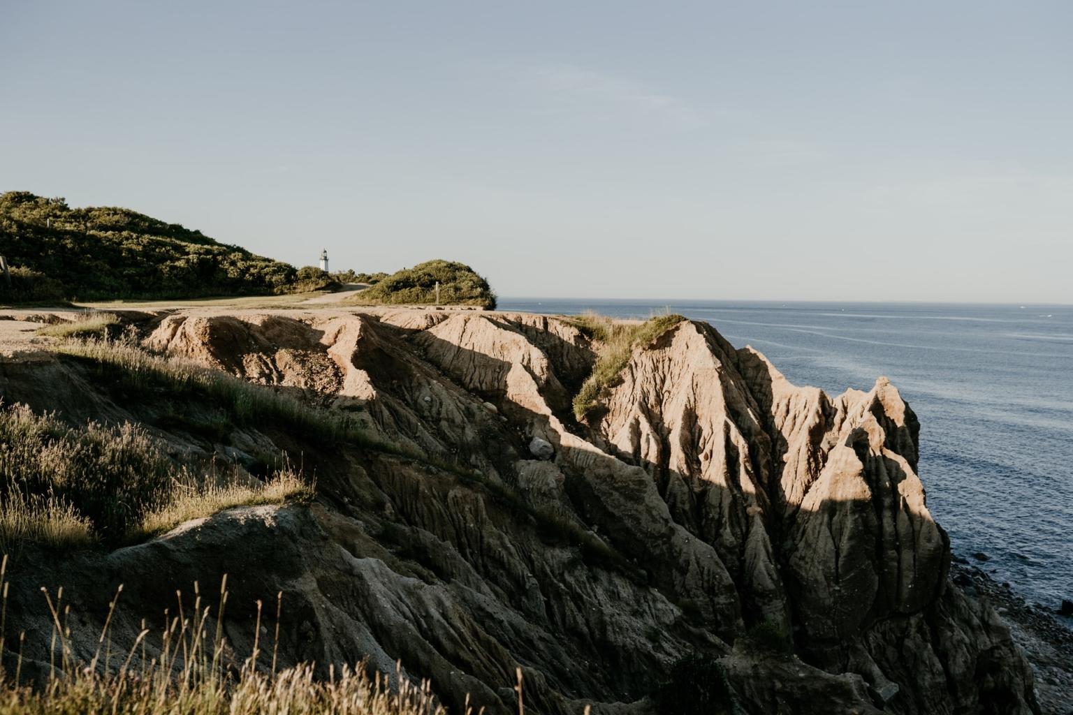
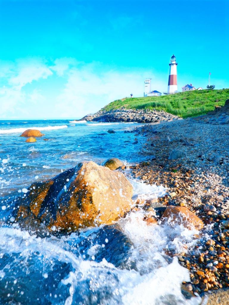

You have now reached the furthest tip of Long Island at Montauk State Park. Visiting the lighthouse here is a must, but the trails also offer some absolutely spectacular views of the waters from the Block Island Sound and the Atlantic Ocean.
If you want to experience everything, you could hike the Montauk Point Loop, which takes you around the lighthouse and southwest down the bluffs. The trail turns north through woodland toward Oyster Pond. That part of the trail can get muddy, so make sure you’re wearing good hiking boots and not sneakers or trail runners.
One of the best things about Montauk State Park is that there is a trail for everyone. Whether you’re looking for a 30-minute walk or want to hike for over two hours. This is one of the most unique places on Long Island, so I strongly suggest you take the time here to enjoy it!
By the way, don’t forget our guide to the best beaches in Montauk to visit!
- Location: Montauk, Long Island, New York
- Difficulty: Easy
- Length: 6 miles
- Entrance fee: $8 for vehicles
Hiking on Long Island can be an absolute joy if you’re smart about timing and how you get out here. Just take precautions and plan accordingly, and you’ll be able to witness the marvels of Long Island’s diverse environment.
Our Other Long Island Travel Guides
- Cool Things to Do in Montauk, NY – The Most Eastern Point of New York State!
- 17 Luxury & Boutique Hotels in the Hamptons
- Fun Kayaking Spots on Long Island – From East to West!
- Our Favorite Long Island Breweries to Visit for Craft Beer & Tastings
- Charming Small Towns on Long Island to Explore
Pin Me for Later!

About the Author: Kyle Barr

Kyle Barr has been writing and reporting on Long Island and New York for almost a decade. He is a lover of history and nature. You can sometimes find him roving east to west to find ingredients for whatever esoteric meal he’s concocting at the moment.
Thanks for your comprehensive L. I. hike and park info
Very informative article. Now there should be even more crowds at these places!!! At this point, I’m finding stealth hiking much more enjoyable. Away from the humans. Worth getting eaten by some creature in the woods or bitten by dozens of ticks to be with a few choice friends away from the general public. I have a few hidden gems I go to but I will not divulge. Anyway, happy hiking……
Why did you even leave this comment? What was the point? To express your pride of gatekeeping nature? Cool.
Great list and write up, but one question: why are there no maps showing the location of these places on the Island, and why are there no maps of the trails within each park?
Would you like her to spoon feed you your breakfast in the mornings, too? 🙂
Great round up. Excited to check out some of these places. Thank you for putting this wholesome guide together.
Vert informative article